Wicklow Way Stage 3
Distance: 10km (approx.)
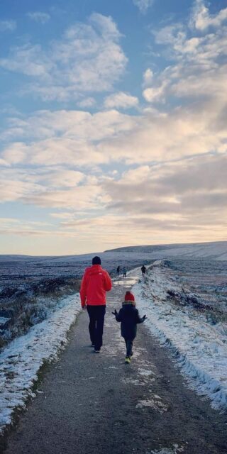
The shortest of all the 7 days but not to be rushed! A long section of country road is rewarded with beautiful mountain trail as we take the first short climb, bringing us to the Brushers Gap Hut, a perfect spot for a picnic. This is one of three huts along the Wicklow Way which were built by ‘Mountain Meitheal’ volunteers.
After leaving the hut, the route brings us out onto the open mountain. Above us, to the west, the Gosan Stones mark the sunrise on the equinox, twice a year. The route descends to the Glenmacnass Valley with an opportunity to exit to the south to reach Laragh Village. See below.
Continuing along the Wicklow Way a short climb provides us with our first views of the renowned Glendalough Valley. The end is near and all downhill as we reach the Glendalough Visitors Centre.
(Day 4 is a long one and it’s a good idea to use the remainder of today to explore Glendalough and the Monastic City.)
Roundwood (Baltynanima Crossroads):
You have reached the end of this stage when you reach a crossroads of three tarmacadamed roads and a lane. At this point, you can walk straight through the crossroads to reach Roundwood Village and its’ services in another 2.5km (30 minutes). Most local accommodation providers will be happy to collect you from this crossroads if you ring ahead.
As the highest village in Ireland, Roundwood is in an enviable location surrounded by lakes, woodlands and mountains. With a range of activities from the doorstep, accommodation types and dining options to suit all budgets, it’s an ideal base for any outdoor enthusiast!
Things to do & see near here:
Roundwood Summer Festival, Mountain biking at Ballinastoe with Biking.ie, a round of golf at Djouce Mountain Golf Club, Victor’s Way Contemplative Sculpture Garden (adults only), Fishing on Varty Reservoir (licence required), Vartry Reservoir Walk.
Exit Point 5 – Glenmacnass Military Road (Laragh)
The main village of Laragh is located just under 2km by road/path from the end of this stage at Glendalough Monastic Site
Exit Point 6 – Laragh – St. Kevin’s Church & School
Distance from Wicklow Way to Laragh Village centre: 1.5km (approx.)
After crossing the footbridge over the Glenmacnass River, ignore the Wicklow Way marker directing you to the right, exiting at this point by continuing straight until you reach the main forestry track. Turn left here and stay on this track until you reach a yellow and black barrier. The school is now directly opposite you and the church is to your right. By turning either right or left, you will soon reach the centre of the village. Taking the right-hand route will also bring you past The Brockagh Resource Centre and adventure.ie Outdoor Store on your way.
The village of Laragh proper on the edge of the ancient monastic site of Glendalough, and almost directly on your path. Laragh contains everything you would expect to find in a picturesque mountain village and more. From outdoor store to mini market, deli counters and cafés to replenish your stores, award winning restaurant food with an historic literary vibe (a highly recommended treat!), hostels to hotels – and everything in between. Laragh village is a mecca for hikers and bikers, road cyclists, climbers and kayakers with plenty for families and those taking their first steps in the outdoors to enjoy too.
Distance walked on this stage so far:
Stage 1: N – S: Distance walked from Roundwood (Baltynanima Crossroads): 7.5km (approx.)
Stage 7: S – N: Distance walked from Glendalough 2.5km (approx.)
Things to do & see near here:
Visit Glendalough’s ancient monastic city, check out the old mining villages, stay a while longer and do the Avonmore Way or any of the waymarked walks in Wicklow Mountains National Park. Drop by the Visitor Centre beside The Glendalough Hotel or The Information Office at the Upper Lake. Go hiking, rock-climbing or bouldering with assistance from adventure.ie, see the Glenmacnass waterfall, take a spiritual retreat, go trail running, visit Clara Lara Fun Park just outside Laragh, go fishing at the Annamoe Trout Fishery.
Glendalough (Visitor Centre)
When you pop out opposite The Glendalough Hotel, the end of this stage (at the visitor centre) is a few hundred metres to your left.
For most visitors, Glendalough needs no introduction. A valley chiselled out by glacier, Glendalough – the valley of two lakes, boasts the fine remains of an ancient monastic settlement, complete with round tower to hide treasure from Viking raids. It has been the source of many wonderful archaeological finds and plenty of tales. But, more than that – and possibly the reason it was chosen as a monastic settlement, is the sense of peace and serenity that pervades the entire valley of Glendalough and draws people back, time and time again. The Glendalough Hotel offers free Wifi available in the lobby.
Things to do & see near here:
Glendalough is a renowned area of Ireland’s Ancient East and since today is a short walking day, it is the ideal opportunity to visit the ancient Monastic ruins, round tower, twin lakes and seven churches of Glendalough, The Glendalough Visitor Centre (beside the hotel), The Information Office at the Upper Lake for free advice and information. See also Things to do list in Laragh above.
More info on Glendalough: http://visitwicklow.ie/attractions/glendalough-monastic-city/
POINTS OF INTEREST
Gossan Stones
A short deviation from the Wicklow Way near the crest of Paddock Hill brings you to the Gossan Stones. There are two stone pillars set on the north/south axis. Not very noteworthy as they only stand just over a metre tall, which may explain where their name came from – ‘gossoon’ being a slang word for a young boy. Archaeologist, Chris Corlett, believed that the stones played a role in ancient Ireland and he discovered on the equinox in March and September each year that the rising sun appears through the deep grove of the Devils Glen to the East and aligns through the two stones for a brief time. These stone alignments could have served as a calendar to ancient farmers indicating a time for planting and harvesting
Google Maps: 53.027742, -6.293974
Glendalough
The home of St Kevin, rich in early medieval history. The ruins of the Monastic City form the centre piece of the historical element of the valley, however, the valley floor is dotted with churches, cells, enclosures and is worth spending time to explore. St Kevin came, with fellow monks, to the valley to seek solitude in 6th century. However, it wasn’t long before he had gained a large following who settled in the valley. The monastery that St Kevin started flourished and continued for 6 centuries after. It was raided by the Vikings and oak from the valley was used to build the second largest Viking longboat ever discovered. Recent archaeological discoveries link the monastery with Iceland, Greenland and mainland Europe. The present ruins date from the 11th & 12th century.
Google Maps: 53. 010853, -6.327532
Geology: Scarr Mountain
As the Wicklow Way progresses along Paddock Hill (Brushers Hut) Scarr Mountain dominates the view to the North. Unlike many of the other summits in Wicklow, Scarr is more ridge shape than the more common rounded summit shape we see in Wicklow. Scarr takes it’s name from the Irish for rocky ridge – Scor. Scarr owes its ridge shape to mica-shist rock. Mica-schist was formed by the baking effect of the molten granite that forms the bedrock of the Wicklow Uplands. This crust of mica-shist has eroded away in most areas but still exists on Scarr.
Fauna: Deer
The mighty Red deer was Irelands native deer and once found roaming all over Ireland. Now their numbers have dwindled and only a handful are found in the Wicklow Mountains. There are an abundance of Sika deer or hybrids of Sika/Red. The Sika was introduced into the Powerscourt Estate in North Wicklow in 1859. It soon escaped and interbred with the native deer. Fallow deer can also be found. Deer numbers in the Wicklow Mountains are huge and are estimated to be as high as 50,000.